HIGHEST MOUNTAIN IN QUEENSLAND: 1622 metres
NATIONAL PARK: Dogs not allowed
DISTANCE: 15 km
TRACK CLASS: Marked route
DIFFICULTY: Strenuous
TIME: 12 hours
TYPE OF WALK: Return
WHERE: Track starts at Josephine Falls
SAFETY:
To undertake this walk you will need to:
*be fit and experienced to undertake this hike.
*have the correct maps and a compass.
*have adequate food and water.
*bring clothing for extremely cold and wet weather.
*bring a fuel stove (no fires are permitted).
*give trip details to a responsible person.
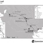
MAP: Click here to download and print .pdf version
DESCRIPTION:
Towering above the fertile coastal plain 70 kilometres south of Cairns are the highest mountains in Queensland, Mt Bartle Frere (1622 metres) and its neighbour Mt Bellenden Ker (1593 metres). These mist-shrouded green giants are an important water source for nearby townships and keep the vegetation looking lush and green. More than 8 metres of rain falls on the summits of these mountains each year and over 1140 mm of rain has been recorded in 24 hours – one of the highest rainfall intensities in the world. There is a 10-12 hour walk to the Bartle Frere summit for experienced hikers.
This 15 kilometre mountain rainforest trek is extremely demanding. The Bartle Frere East hike should only be undertaken by experienced bushwalkers. It is recommended that you allow two days for the ascent to the summit and back to either the east (Josephine Falls) or the west (Tablelands). There are two overnight campsites and a permit is required before you depart. If you plan on a one day trip, be aware that it will take approximately 12 hours. Preparation is important for all hiking on Mt Bartle Frere, as it is likely you will encounter variable weather conditions. These may include heavy rainfall, reduced visibility from cloud , cold temperatures and sudden weather changes.
The track begins at the Josephine Falls carpark close to the ranger’s office. The beginning of the track is wide and clear through a tropical rainforest. It takes approximately one hour to reach Majuba Creek. This is a nice place to take a break, sit beside crystal clear mountain pools and towering boulders. It is a good idea to top up the water here as well. The path then narrows and becomes covered with rocks and the gnarled root systems of dense forest. Follow a narrow ridge towards the first of the two campsites known as Big Rock. Majuba Creek intersects the path one more time before a set of steep scrambles through boulder fields and over root ladders. The vegetation takes a new, more sporadic, scrubby form with an increase in altitude. After this steep climb the second, upper campsite is located. From atop the granite slabs there is a spectacular view of rainforest, sugar cane fields, Barrier Reef islands, and the Coral Sea coast. From the summit you can return to Josephine Falls or continue on to the west (see Bartle Frere West).
Remember that you will need to obtain a permit if you wish to camp overnight on Bartle Frere. See the DERM website. Self registration forms available at the beginning of the walk should also be filled in by all walkers.
 Information supplied courtesy of the Wet Tropics Management Authority

